Pilgrimage
Adi Kailash Yatra Guide: Route, Permit, Best Time & Om Parvat
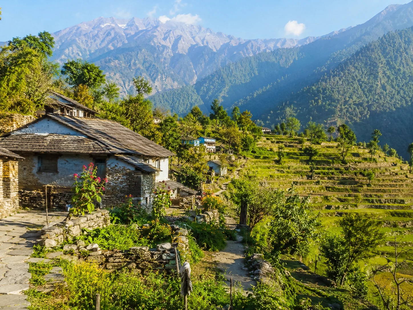
Adi Kailash is one of Uttarakhand’s most remarkable high-altitude pilgrimages, reached through the remote Vyans Valley near the Indo-Tibetan border. This guide covers the route from Dharchula, Inner Line Permit, Om Parvat, Parvati Sarovar, best time to travel and the realities of completing the yatra safely.
Opening note
The Adi Kailash journey does not really begin when the mountain appears.
It begins much earlier, in Dharchula.
By the time you reach this small border town, the journey has already changed character. The Kali River flows beside the road with Nepal on the opposite bank. Bags are being rearranged for smaller vehicles. Documents are checked. Permits matter here. Weather matters. And suddenly the road ahead is no longer something you can treat like an ordinary hill drive.
Beyond Dharchula, the valley starts narrowing.
The route follows rivers and cliff-cut roads through settlements such as Budi and Garbyang before climbing towards Gunji. Distances that look manageable on a map begin taking hours. A clear morning can become cloudy before lunch. The landscape grows emptier, the mobile network less dependable and every night halt noticeably higher than the one before.
Gunji becomes the centre of the journey.
From here, one route moves towards Kalapani and Nabidhang for the view of Om Parvat. Another turns through the Vyans Valley towards Kuti and Jolingkong, where pilgrims approach Adi Kailash and Parvati Sarovar.
These are two different mountains and two different darshans, even though they are usually spoken about together as one yatra.
And when Adi Kailash finally comes into view, the kilometres travelled begin to matter less than the route that brought you there.
Orientation
Know the place
Adi Kailash lies in the high Himalayan region of Pithoragarh district in Uttarakhand, close to the Indo-Tibetan border. It is also widely known as Chhota Kailash and holds deep religious importance because of its association with Lord Shiva and Goddess Parvati.
The pilgrimage is centred around the upper Vyans Valley, with Dharchula serving as the main gateway and Gunji becoming the important base for the final sections of the journey.
Near Jolingkong lies Parvati Sarovar, the small sacred lake from where travellers receive one of the most memorable views of the Adi Kailash landscape. A Shiva temple also stands in this high-altitude setting.
The journey has changed considerably in recent years. What once required a long and difficult trek can now be completed largely by road in suitable four-wheel-drive vehicles. That has made Adi Kailash accessible to many more pilgrims, but it has not made the environment easy.
Gunji is already above 3,000 metres, while the final areas around Nabidhang and Jolingkong rise well above 4,000 metres. Altitude, cold, rough roads and rapidly changing weather remain serious parts of the journey.
Adi Kailash should also not be confused with Mount Kailash in Tibet. Adi Kailash lies entirely within India. The pilgrimage does not cross the international border, although the route enters a sensitive border region where travel is regulated through permits and security checks.
02 · Why it matters
More than a point on the map
There is something unusual about a pilgrimage where the final destination is not a building.
At Kedarnath, the temple eventually appears.
At Badrinath, you arrive at the shrine.
At Adi Kailash, the mountain itself remains the centre of attention.
You travel for days through the Kumaon Himalayas, climb into the Vyans Valley, cross security checkpoints and sleep in settlements where the cold becomes noticeably sharper after sunset. Then, if the weather allows, the clouds move and the mountain appears beyond Parvati Sarovar.
Nothing has to be entered.
Nothing has to be completed.
You simply stand there and look.
The second remarkable part of the journey is that Adi Kailash is usually paired with Om Parvat, but the two should not be treated as the same place.
Om Parvat is viewed from the Nabidhang side of the route. Its fame comes from the natural snow pattern on the mountain face that resembles the sacred symbol ॐ. Whether the full shape is clearly visible depends heavily on snow and cloud conditions.
Adi Kailash lies on the other branch of the journey towards Jolingkong and Parvati Sarovar.
Gunji connects these two directions.
That geography gives the yatra an unusual rhythm: one morning you may be looking towards Om Parvat, and the next you may be travelling towards the stillness of Parvati Sarovar beneath Adi Kailash.
The journey is therefore not defined by one viewpoint.
It is defined by the entire valley.
04 · Plan
Plan smart, travel easy
How to reach
By road
Dharchula is the main road gateway for the Adi Kailash and Om Parvat Yatra.
Travellers reaching Dharchula from the Kumaon side generally approach through Tanakpur, Champawat and Pithoragarh. Another common approach begins from Kathgodam or Haldwani and continues through the Kumaon hills towards Pithoragarh and Dharchula.
From Dharchula, the high-altitude journey continues by mountain vehicle towards Budi, Chhiyalekh, Garbyang and Gunji.
The current road has made the pilgrimage much easier than the older trekking route, but the road beyond Dharchula remains narrow, rough and highly dependent on weather.
Gunji acts as the main junction for the two principal darshan routes.
For Om Parvat, the journey continues from Gunji towards Kalapani and Nabidhang.
For Adi Kailash, the route turns towards Kuti and Jolingkong, followed by the sacred landscape around Parvati Sarovar.
Do not calculate journey time only from kilometres. A relatively short section in this terrain can take several hours because of road condition, security checks, landslide clearance and weather.
By train
Kathgodam Railway Station is the most practical major railway gateway for travellers approaching Adi Kailash from the Kumaon side.
From Kathgodam, continue by road towards Pithoragarh and Dharchula. Because the road journey is long, it is better to divide the approach rather than trying to combine an overnight train, a full mountain drive and the high-altitude yatra without proper rest.
Tanakpur is another useful railway approach, particularly for itineraries travelling through Champawat towards Pithoragarh and Dharchula.
By air
Naini Saini Airport near Pithoragarh is the closest airport to the region when scheduled flights are operating.
Pantnagar Airport is another option, but it involves a much longer onward road journey through Kumaon.
schedules in the hills can be affected by weather, so keep sufficient flexibility if your permit dates or organised yatra departure depend on reaching Dharchula on a particular day.
Best time to visit
May to mid-June
This is one of the main windows for the Adi Kailash Yatra.
By May, the route begins reopening after winter and organised pilgrim movement starts once road and snow conditions permit. Snow may still remain around the higher sections, while the weather is usually more stable than during the monsoon.
Nights at Gunji, Nabidhang and Jolingkong can still be very cold.
Early-season travellers should carry proper winter layers even when lower places such as Dharchula feel warm.
Late June to August
This is the most uncertain period.
The monsoon can bring heavy rain to the lower and middle sections of the route, increasing the risk of landslides, road closures and long delays. Higher areas may experience a completely different weather pattern from Dharchula on the same day.
Permit issuance and pilgrim movement can also be restricted or temporarily suspended when conditions become unsafe.
If possible, avoid choosing peak monsoon for a first Adi Kailash journey.
September to October
This is often the best overall period for the yatra.
After the monsoon begins withdrawing, the mountains can offer clearer views and road conditions generally become more dependable. September retains some greenery in the valleys, while October brings colder air and increasingly crisp mornings.
The trade-off is temperature.
Nights at higher halts become considerably colder as October progresses, and early snowfall can affect the upper route.
For travellers whose main priority is seeing Adi Kailash and Om Parvat clearly, this is one of the strongest periods to consider.
Late October to mid-November
Travel can remain possible when the season and road conditions allow, but this period requires greater flexibility.
Temperatures drop sharply, water can freeze overnight at higher elevations and snowfall may close parts of the route with little warning.
Do not choose late season simply because fewer people are travelling. Check the current yatra status before leaving Dharchula.
People & place
Food and local culture
Food on the Adi Kailash route is less about choice and more about eating properly.
Once you leave Dharchula, restaurants, shops and supplies become progressively limited. Meals at homestays and organised halts are generally simple: dal, rice, roti, vegetables, tea and whatever can practically be prepared and supplied at that altitude.
That is exactly what you need.
Eat even when altitude reduces your appetite. Drink water regularly. Avoid travelling through the day on tea and packaged snacks simply because you do not feel hungry.
The route also passes through the traditional homeland of the Rang community, particularly in the Vyans Valley.
Villages such as Budi, Garbyang, Gunji, Nabi and Kuti are not merely stops on a pilgrimage map. They belong to a region with a long history of trans-Himalayan movement, trade and mountain life.
The road has changed these valleys quickly. More pilgrims can now arrive in a single season than would once have passed through over much longer periods.
That makes traveller behaviour important.
Use local homestays where appropriate. Buy food and basic supplies locally when available. Ask before photographing people or homes. Do not treat traditional villages as scenery between two famous viewpoints.
For visitors, Adi Kailash may be a once-in-a-lifetime journey.
For the people living here, this is home.
Before you leave
Plan with care
Useful notes
- An Inner Line Permit is mandatory for the Adi Kailash and Om Parvat route beyond Dharchula. Do not begin the restricted section of the journey without the required authorization.
- Complete your permit preparation before your departure date. Requirements can change between yatra seasons, but travellers should expect identity documents, registration paperwork, medical or fitness documentation and other declarations required by the administration.
- Current organised KMVN journeys also require documentation such as a fitness certificate and indemnity paperwork. Police verification requirements may vary depending on the identity document being used, so confirm the current rules before submitting your application.
- Carry original identification as well as photocopies. Keep permit copies protected from rain and easily accessible because documents may be checked more than once.
- Do not treat the permit as a formality that guarantees travel. Weather, landslides, security restrictions and local administration can still stop movement even after a permit has been issued.
- Spend enough time acclimatising. The altitude rises quickly between Dharchula and Gunji, and the final darshan areas are above 4,000 metres.
- Drink water regularly even when you do not feel thirsty.
- Avoid alcohol before and during the high-altitude portion of the yatra.
- Carry proper layers rather than one heavy jacket. Conditions can move from strong sunlight to cold wind within a short period.
- Keep gloves, a warm cap, sunglasses and sunscreen accessible during the day.
- Carry essential personal medicines from Dharchula. Do not assume that a specific medicine will be available in Gunji or other upper-valley settlements.
- Keep one buffer day in your itinerary. This journey is highly vulnerable to weather and road delays.
- Use a suitable mountain vehicle and an experienced local driver for the restricted upper route. This is not the place to judge road difficulty from satellite maps.
- Do not rush from Gunji directly towards the highest point simply because you feel fine on arrival. High-altitude symptoms can develop after several hours.
- For Om Parvat, keep expectations realistic. The ॐ-shaped snow formation may be hidden by cloud or may look different depending on seasonal snow.
- Carry back every piece of non-biodegradable waste you take into the upper valley.
Things to avoid
- Do not travel beyond Dharchula without a valid Inner Line Permit.
- Do not ignore headache, nausea, dizziness, unusual fatigue, breathlessness at rest or confusion at high altitude. These can be warning signs that your body is not adapting properly.
- Do not hide symptoms because you do not want to miss darshan. Descending is more important than completing an itinerary.
- Do not assume road access means the yatra is easy. The long vehicle journeys, rough roads, rapid altitude gain and cold can be exhausting even without a traditional multi-day trek.
- Do not photograph military posts, security checkpoints or sensitive border infrastructure.
- Do not wander away from the approved route in the restricted border region. Follow instructions given by local administration and security personnel.
- Avoid unnecessary travel during heavy rain. A road that was open in the morning can be blocked later by a landslide or falling debris.
- Do not depend entirely on mobile connectivity or online payments once you move beyond Dharchula.
- Do not leave plastic bottles, food wrappers, wet wipes or disposable rainwear in the valley. Waste is considerably harder to remove from these remote settlements than it is to carry there.
- Do not pressure drivers to move faster because you are running behind schedule. The mountain decides the safe speed.
- Do not compare your ability with other pilgrims. One person may feel comfortable at 4,000 metres while another experiences symptoms at a lower altitude.
- Do not plan the yatra with zero buffer days.
07 · Make it yours
Suggested itinerary
- Day 1 – Reach Dharchula: Arrive in Dharchula, complete any remaining permit and document formalities, arrange the authorised upper-route vehicle and rest. Keep this day deliberately light rather than treating Dharchula as somewhere to pass through immediately.
- Day 2 – Dharchula to Gunji: Leave early and begin the long mountain drive through the upper valley. Pass through the Budi–Garbyang side of the route before reaching Gunji. Once there, avoid unnecessary exertion and use the evening to acclimatise.
- Day 3 – Om Parvat Darshan: Travel from Gunji towards Kalapani and Nabidhang for Om Parvat. Spend enough time for the weather to clear if conditions permit, then return to Gunji rather than trying to combine both major darshans in one hurried day.
- Day 4 – Adi Kailash and Parvati Sarovar: Leave early towards the Kuti–Jolingkong side of the valley. Visit the Adi Kailash darshan area and Parvati Sarovar, keeping your walking pace slow at altitude. Return according to the approved route and night-halt arrangement.
- Day 5 – Return towards Dharchula: Begin the descent from the upper valley. The return may feel easier because of decreasing altitude, but the road remains long and rough, so keep the entire day available.
- Day 6 – Buffer and onward journey: Keep this day available for weather or road delays. If the yatra has run on schedule, use it for the onward journey towards Pithoragarh, Champawat, Tanakpur or Kathgodam.
A final note
Adi Kailash has become easier to reach.
That does not mean it has become ordinary.
A road now carries people through a valley that once demanded days of walking. Vehicles reach places that earlier generations of pilgrims approached slowly on foot. More people can see Om Parvat, travel through Gunji and stand beside Parvati Sarovar than ever before.
That is a good thing in many ways.
But ease of access can create the wrong expectation.
The road does not remove the altitude.
It does not control the weather.
It does not guarantee that Om Parvat will emerge from the clouds.
And it certainly does not make the upper Vyans Valley less fragile.
Perhaps the best way to travel here is to accept those limits before you begin.
Carry the right documents.
Give yourself time.
Listen when the driver says the road is not good.
Turn back if your body is not adapting.
Wait when the weather asks you to wait.
Then, if the clouds open above Jolingkong and Adi Kailash appears beyond the water, you will not need anyone to tell you what to do next.
For a while, simply look.
No approved comments yet. Be the first to share your thoughts.